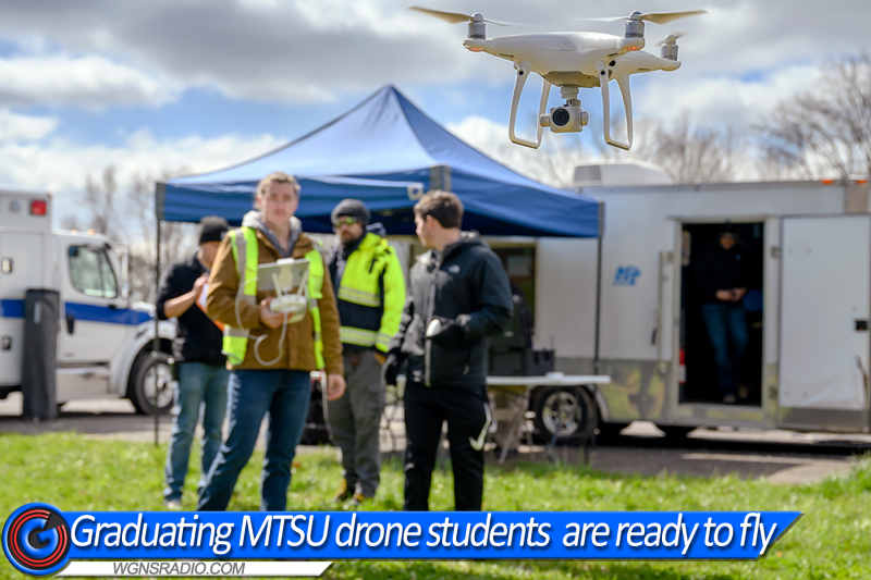
MURFREESBORO, Tenn. — Concluding a senior project, six MTSU Aerospace unmanned aircraft systems students helped write a final chapter to a Tennessee State Park mystery that baffled authorities for nearly 14 months.

Since early February 2021, authorities had been searching for missing hiker Robert “Bob” Qucsai, an attorney from Ohio. Drones, helicopter surveillance and numerous searches had come up empty until March 29 when his remains were finally discovered in the 282-acre Jackson County park near Cookeville.
Corns’ students were up for the mapping challenge
“You can’t duplicate this anywhere else,” said assistant professor Kevin Corns, surveying the students’ in-the-field study at the park.
“We’ll measure this by the end results, including what went right and what they would do differently,” he added. “As long as we can go out and capture the data and take that data and turn it into useful information for our stakeholders (state park officials), then it will truly be a success, but just the learning experience alone is above and beyond anything else.”
Shane Petty, an MTSU alumnus and state parks chief ranger since 1997, spent an entire class period early in the spring semester, providing details about the perplexing Cummins Falls situation. Weeks later, Russell Bradshaw and Jeff Clementi with StormPoint Emergency Response in Smyrna, Tennessee, met with them to discuss drones and equipment.
Scroll down to continue reading...


Drones take to the sky - Continued...
“It’s been an experience of going from beginning to end,” said Hickman, 43, a member of the student team. “He (Petty) started the conversation. We started getting the plan together. You need to make sure you have the right equipment. Then you get to the (physical) place of where you’re going to do the mapping. Now we’re here doing it.”
Plenty of preparation

“These are things we can record, so in future operations, we can recall data that we have to make more accurate adjustments and deal with a better understanding of the equipment we need for the mission.”
Hickman and Harris shifted gears, away from the others, and moved to a spot about one mile away to gain a better vantagepoint for their mapping.
“We found that when we moved closer to the area we were mapping, we could keep the signal,” Hickman said. “The drones were supposed to be flying a mile or so away in perfect conditions — nothing’s around, no Wi-Fi, no cell phone towers, nothing like that. … So, we moved down the road, closer to the area.”
Hickman, who is a TV and film production major in the College of Media and Entertainment, is pursuing a minor in the UAS concentration. He is a veteran, having served 22 years in the U.S. Navy, retiring as a chief petty officer/operations specialist.
Ready to hit the world running
This capstone course is their final one in UAS, to show they “can operate safely in the national air space system,” Corns said. He believes the students are prepared for careers after MTSU.
“This (field mission) is the application,” he said. “They’ve gained the basic skills and knowledge. We’re not going to make them an expert in any one system that’s out there. We’re going to expose them to a lot of different systems. Our goal is to, when they go work for somebody else, is they have the skills to be successful.”
During the semester, Corns’ connections landed them training missions at a quarry in Shelbyville, Tennessee; at a bamboo farm in Almaville, Tennessee; mapping at The Webb School in Bell Buckle, Tennessee; the state park quest; and a number of campus projects.
“There’s a lot of coordination they have to go through, to make sure all the team members are on board, that we have permissions (to fly drones in air space),” Corns said. “… They’ve gotten to experience a lot of different things, that when they go out and work in the industry, they’ll be able to put to good use.”