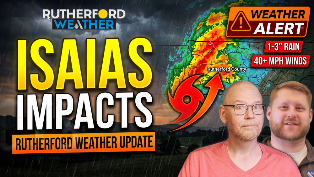
MURFREESBORO, Tenn. (WGNS) - Middle Tennessee is preparing for a wet and windy weekend as the remnants of Hurricane Isaias travel northward after making landfall along the Gulf Coast.

National Weather Service Nashville Lead Meteorologist Cory Mueller joined Rutherford Weather's Bryan Barrett to break down what local residents should expect here in Rutherford County as the tropical system tracks across the region. While forecast models have shifted the storm's track slightly eastward over recent updates, forecasters emphasize that gusty winds will likely represent the most significant threat to Rutherford County and surrounding communities.
"Confidence is high in rain and breezy winds," Mueller noted during the briefing. High winds are slated to begin mid-morning Saturday and peak into Saturday evening. The NWS Nashville office has issued a Wind Advisory covering all of Middle Tennessee from 4:00 AM to 8:00 PM Saturday. Sustained winds will run between 15 and 25 mph, with gusts up to 45 mph. These strong gusts could down tree branches, trigger isolated power outages, and blow around loose outdoor items. Residents are advised to secure Halloween decorations and outdoor furniture before winds pick up overnight.
Along with strong winds, widespread rain will spread across Middle Tennessee starting late Friday evening, with the heaviest rainfall falling Saturday into Saturday night. Most of the mid-state will collect 1 to 3 inches of rain. A Flood Watch is in effect from 1:00 AM Saturday (October 10th) through 7:00 AM Sunday (October 11th) for areas along and south of I-40. Localized ponding on roadways and minor rises along creeks and streams are anticipated, though river flooding is not expected at this time.
Although the overall thunderstorm risk is very low due to limited atmospheric instability, Mueller warned that tropical systems can occasionally produce brief, rapid spin-up tornadoes that develop without traditional thunder or lightning. Forecasters will continue monitoring atmospheric conditions closely throughout Saturday.
The Rutherford County Emergency Management Agency encourages all residents to sign up for free emergency notification alerts through Alert Rutherford powered by Smart911. Residents can receive time-sensitive alerts via phone call, text message, or email. Local updates, live weather camera feeds, and radar coverage remain available online at RutherfordWX.com.
And if you've read this far, you're a weather weenie! So please, if you haven't done so, go to our YouTube, Facebook and X social media platforms and like, subscribe and turn on notifications so you'll continue to be informed on local Rutherford County, Tennessee, weather information. And we have another favor to ask. Share this with your local friends and family to help us grow the Rutherford Weather platforms so we can continue to work hard to provide you this information.

REPORTED THURSDAY
MURFREESBORO, Tenn. (WGNS) - Middle Tennessee residents are preparing for a wet and windy weekend as the remnants of Hurricane Isaias move up through the region.
According to Lead Meteorologist Cory Mueller with the National Weather Service office in Nashville, confidence is high that the system will bring periods of heavy rain and elevated wind conditions across Rutherford County. While current skies remain clear, showers will begin moving into the area early Saturday morning, with the heaviest rainfall and strongest winds expected from Saturday afternoon into Saturday night.
Forecast models indicate widespread rainfall amounts between one and three inches across the mid-state. Areas south of Interstate 40 face higher chances of elevated totals, with a 50 to 70 percent probability of receiving over two inches. While the risk for four or more inches remains low at under 10 percent, isolated higher amounts near the storm's core path cannot be ruled out. The incoming precipitation will provide beneficial moisture given ongoing drought conditions.

In addition to heavy rain, widespread wind gusts between 30 and 40 miles per hour are expected on Saturday. Southern portions of Middle Tennessee and areas near the Tennessee River could experience gusts exceeding 45 miles per hour, creating potential hazards for downed tree branches and localized power outages. Breezy conditions will linger through Sunday afternoon with gusts up to 30 miles per hour as widespread rain tapers off into scattered showers.
While severe weather parameters currently lack strong atmospheric instability, weather officials warn that tropical systems can produce quick, spin-up tornadoes. A low tornado threat remains monitored for Saturday afternoon and evening. Residents are encouraged to secure outdoor items and track updates through https://rutherfordwx.com.