


(RUTHERFORD COUNTY) The Rutherford County Emergency Operations Center (EOC) was activated late Saturday evening, and the Emergency Management Agency continues to urge motorists to use extreme caution on the roads.
Public Safety Director Chris Clark said, “Our main focus was planning and resource management, including calling on additional water rescue teams, deciding on how to transport victims, and pinpointing shelter options.”
Off-duty water rescue crew members from Rutherford County Fire Rescue were called in early on Saturday afternoon for the anticipation of increased responses to motor vehicle accidents and water rescues.
As of 4:00 a.m. Sunday morning, RCFR and teams had performed a total of five water rescues; not including those Murfreesboro Fire Rescue responded to inside the city limits.

“There were around eight victims retrieved in total,” said Clark. “No weather-related injuries,” he added.
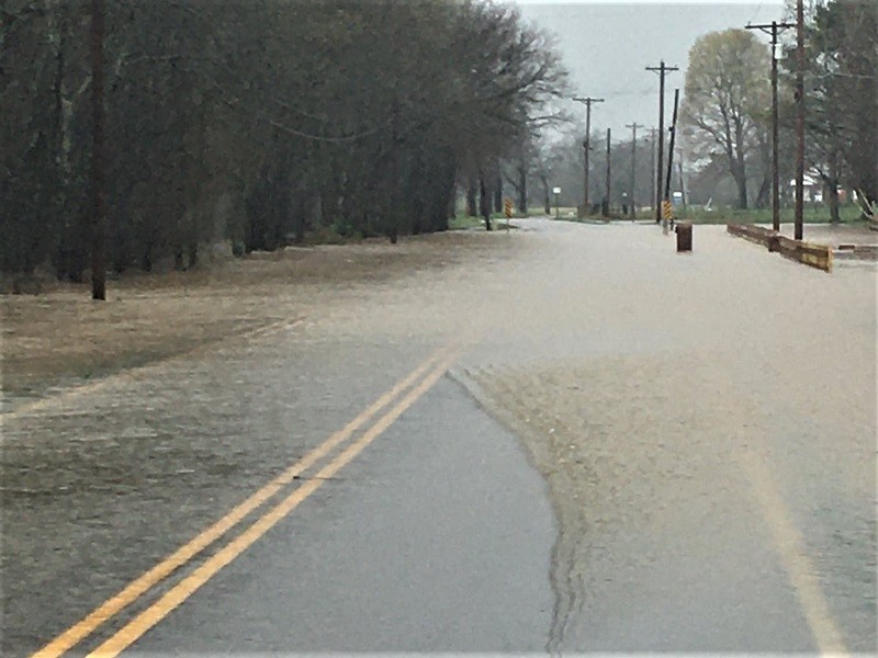
“We have also received several calls with water approaching homes. No evacuations of homes by emergency services were performed.”
Eagleville, Christiana, Rockvale Hardest Hit
Clark acknowledged that the hardest impact was the south side of the county near the City of Eagleville, Christiana, and Rockvale, and cautioned about what morning may bring, “As the sun rises, we anticipate some water rescue responses as people start heading to church and moving about.”
As of around 6:30AM Sunday (3/28/2021) morning, 10 additional calls for service came in, ranging from water rescue to motor vehicle accidents/rollovers.
Clark noted, “It will take a while for the water to recede. The Stones River is out of its banks with nowhere for the water to go. Percy Priest is projected to rise up to 10 feet in the next 24 hours as well.”
As water rescue teams remain on standby, Clark offers the following message, “Please continue to practice extreme caution on the roads. If you have to travel today and encounter standing water, it’s best to turn around.”
Clark also encourages residents to stay “weather aware” as more rain is expected.
The County has a GIS map that is constantly being updated with high water, flooded, and closed roads. The map can be accessed by visiting: https://rcgis.maps.arcgis.com/ apps/opsdashboard/index.html#/ 09d7baee3522455ea617f2b24dea6d c6.