(MURFREESBORO) A cross-section of citizens and local property owners attended a Wednesday (2/23/2022) evening presentation of Murfreesboro's "Future Land Use Map". The event was held between 5:00 and 7:00PM and had a "come and go" format.

City Planning Director Greg McKnight told NewsRadio WGNS . . .
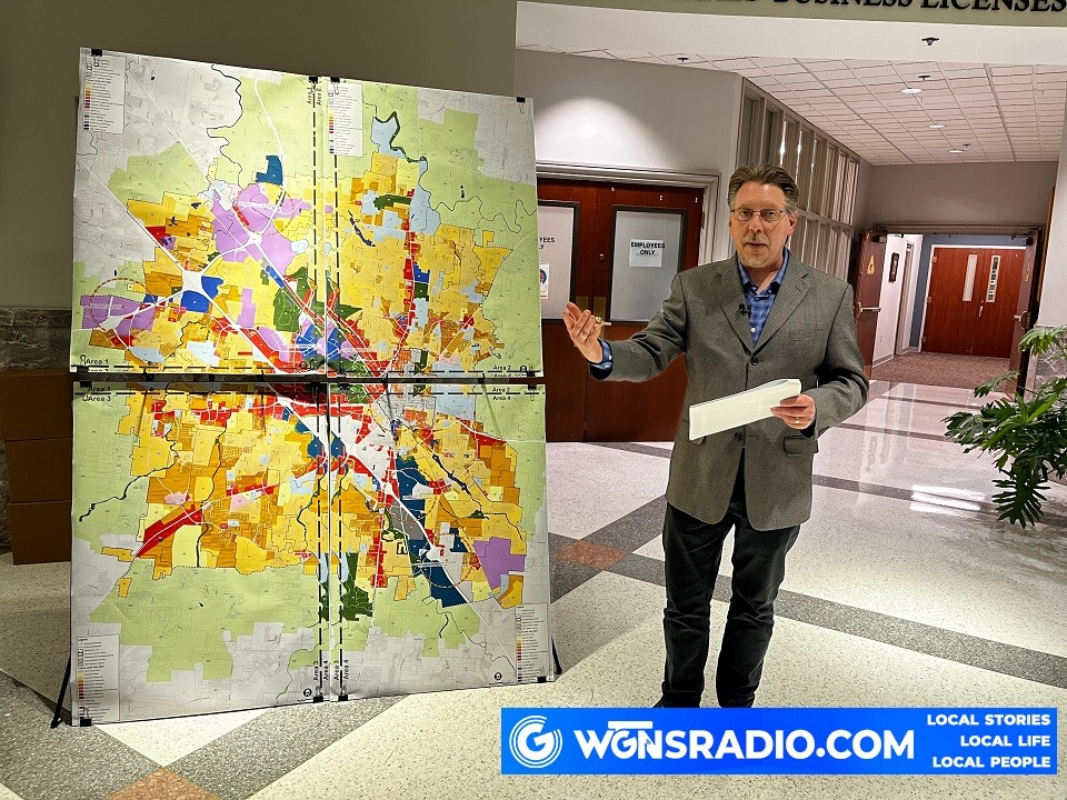
Regan-Smith Associate's Kevin Gunther explained the thoughts behind the large, color-coded maps that dominated the public information stands located at each corner of the City Hall's Rotunda. Gunther is a Murfreesboro resident, and he noted that the area including the light green border represents 180 square miles that are considered to be areas of expansion. The brightly colored 99 square mile area, within the light green zone, shows proposed types of developments that have been suggested for types of businesses, residences and other uses.
Gunther noted that the purple areas were area where businesses are proposed that would generate good incomes.
He indicated that development would be encouraged in the brightly color-coded area of the map, because those parcels already have police and fire protection, city water and sewer service, parks, and other amenities.
The geographic areas in which there is a proposed focus on improvements with business and residential areas includes:
- Veterans Parkway / I-840
- Cherry Lane / I-840
- Medical Center and Gateway
- Downtown
- Hoover site (Middle Tennessee Blvd.)
- Joe B. Jackson Parkway / I-24
Again, Planning Director McKnight explained that the "Future Land Use Map" UPDATE must first go before the Murfreesboro Planning Commission. That is currently scheduled for March 16, 2022. If approved, it then goes before the City Council on March 24, 2022.

Murfreesboro Planning Director Greg McKnight