MURFREESBORO, TN - Rutherford County endured multiple rounds of storms Thursday (12-18-25) moving across Middle Tennessee, bringing heavy rain, strong winds, and frequent lightning through the overnight hours. The system, part of a broader cold‑front boundary sweeping the midstate, triggered watches and warnings throughout the day and kept emergency crews busy well into the evening.
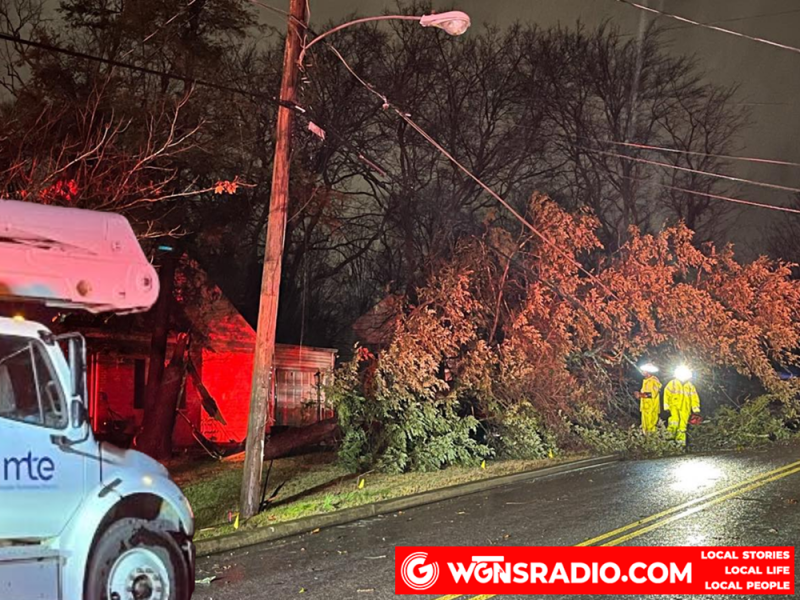
Murfreesboro Fire Rescue Department responded to a steady stream of calls as the strongest storms pushed through late Thursday. Crews reported downed power lines, trees blocking several roadways, and multiple incidents of trees falling onto homes. Despite the widespread wind damage, officials confirmed only minor injuries and said no major structural damage had been verified as of Thursday night.
Middle Tennessee Electric worked through the evening to restore power to affected neighborhoods, with outages scattered across the county as wind gusts reached an estimated 40 to 60 miles per hour. Residents were urged to avoid downed lines, treat all wires as energized, and report hazards immediately to local authorities.
The day began with a band of steady but sub‑severe rain that moved across the region with little lightning. Forecasters had placed Rutherford County under a Marginal Risk—level one out of five—for severe weather, noting that damaging winds were the primary concern. As the main line of storms arrived from the west late in the afternoon, conditions intensified quickly. WGNS Radio tracked the storms as they entered the county from the Chapel Hill area, providing live updates as the line marched eastward.
While meteorologists noted that an isolated tornado could not be ruled out, the overall tornado threat remained low. The more persistent issue was the wind, which stayed elevated even after the heaviest rain moved out. By early Friday morning, the storms had cleared the area, leaving behind cooler temperatures and a trail of debris for crews and homeowners to address.


