Mississippi River at Historic Low Levels in October 2022
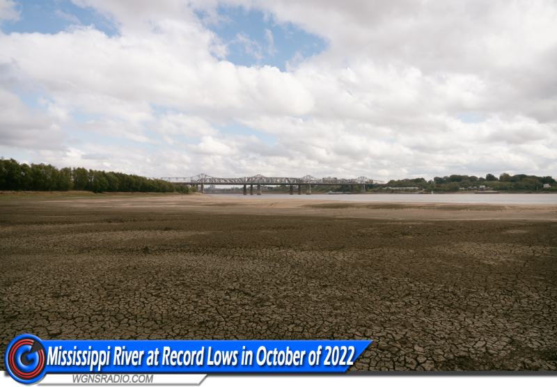
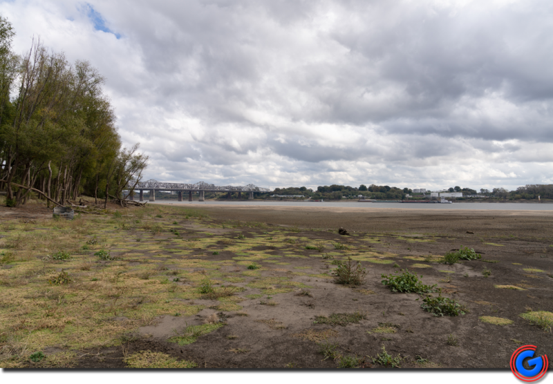
Mississippi River on Sunday, October 30, 2022, just before 12 Noon. This is next to the Highway 55 Bridge and railroad overpass on the Arkansas side, looking away from Memphis, downstream the Mississippi River and towards Mississippi. Photo by Scott Walker.
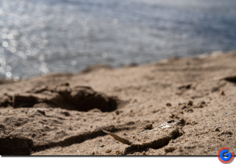
Mississippi River on Sunday, before 12 Noon. This is under the Highway 55 Bridge on the Arkansas side, looking towards Memphis. This is a dead fish in the sand, an example of wildlife lost. Photo by Scott Walker.
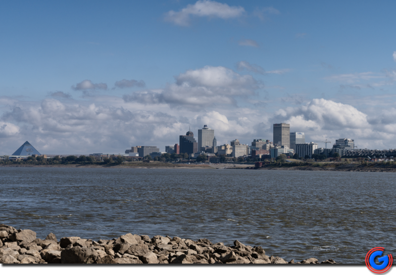
Mississippi River Sunday, October 30, 2022, at 12 Noon. Next to the Highway 55 Bridge on the Arkansas shore, looking towards the Memphis, Tennessee skyline and Pyramid. Photo by Scott Walker.
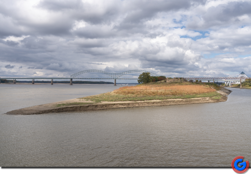
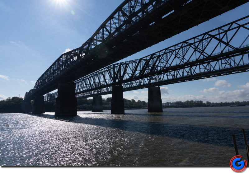
Standing on the Memphis Side looking towards the Pyramid, the Interstate 40 Bridge that spans the Mississippi River between Memphis, TN and West Memphis, Arkansas – looking at the tip of Mud Island on the drought-stricken Mississippi River – Sunday, Oct. 30, 2022 at 12pm. Photo by Scott Walker.
Mississippi River on Sunday, October 30, 2022, just before 12 Noon. This is under the Highway 55 Bridge on the Arkansas side, looking towards Memphis in drought conditions. Photo by Scott Walker.
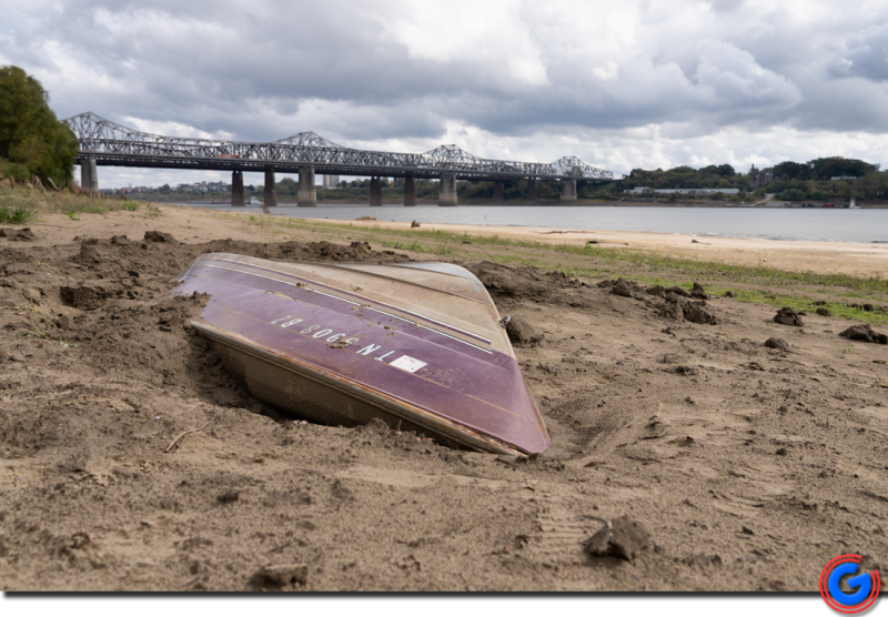
Boat uncovered as water level dropped. Unknown seekers dug around it. Sticker on the boat was faded, but said 2012, TN. In Mississippi riverbed. Looking towards Memphis, HWY 55 bridge. Photo by Scott Walker.
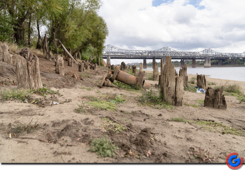
Mississippi River on Sunday, October 30, 2022, just before 12 Noon. This is next to the Highway 55 Bridge and railroad overpass on the Arkansas side of the river - looking towards Memphis. Photo by Scott Walker.
This is next to the Highway 55 Bridge on the Arkansas side of the Mississippi River, looking towards the bridge of HWY 55. Photo by Scott Walker.
Mississippi River on Sunday, October 30, 2022, just before 12 Noon. This is next to the Highway 55 Bridge and railroad overpass on the Arkansas side of the river - looking towards Memphis. Photo by Scott Walker.
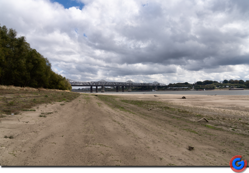
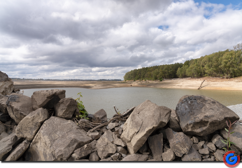
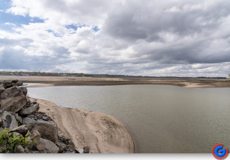
Down river from the Memphis Pyramid on the banks of Arkansas, lot's of sand and rocks are uncovered as Mississippi River levels are extremely low. There are pools of water in some areas, due to the low water levels. Photo by Scott Walker.
Down river from the Memphis Pyramid on the banks of Arkansas, lot's of sand and rocks are uncovered as Mississippi River levels are extremely low. There are pools of water in some areas, due to the low water levels. Photo by Scott Walker.